

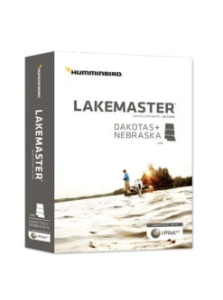
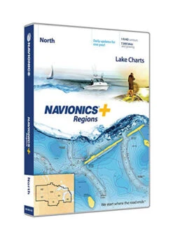
Lakemaster Great Lakes Map Card
Original price was: $124.99.$87.49Current price is: $87.49.
- Efficiency meets excellence in customer care.
- Free 1 year warranty period
- Multiple payment methods, 100% payment security
- High quality products, low prices.

Description
Lakemaster Great Lakes Map Card
The Lakemaster Great Lakes Map Card has a shallow water area for Lake Michigan & parts of Superior; as well as full coverage of Superior; all Lk Huron (incl Georgian Bay); Beaver Island on Michigan in HD; new HD survey of Lake St Clair (incl Canadian side); updated St. Clair River HD survey (incl Canadian side); updated Detroit River HD survey (incl Canadian side); HD survey of Syracuse, Kosciusko – IN; Wamplers, Lenawee – MI; Portage/Torch, Houghton – MI; and also Lower Grand & Spring Lake – MI
LakeMaster SD/micro cards include features such as Depth Highlight, Shallow Water Highlight and Water Level Offset, which can be used exclusively with Humminbird fish finders
Features
- Can be used with Minn Kota i-Pilot Link allowing you to “Follow” a selected depth contour line, delivering precise, automatic boat control
- Scrollable lake list allows you to view and research lakes from your Humminbird fish finder on and off the water
- The Great Lakes product no longer includes Kentucky and Tennessee lakes. See the LakeMaster SouthEast Edition products for lakes in these states.
- Opened packages are not eligible for return.
- LakeMaster cards are compatible with all GPS-equipped HELIX, SOLIX, ONIX and ION Series models, and also along with select 600-1100 Series models.
- The Great Lakes product no longer includes Kentucky as well as Tennessee lakes. See the LakeMaster SouthEast Edition products for lakes in these states.
- 30-Day Cartography Warranty
Check out more Map Cards for Ice here.
Be the first to review “Lakemaster Great Lakes Map Card”
Related products
Ice Electronics
Ice Electronics
Batteries & Chargers
Humminbird Ice & Accessories
Ice Electronics
Batteries & Chargers
Ice Electronics
Garmin Ice & Accessories
Reviews
There are no reviews yet.